
|
Vol 79 |
Page 9 |
Privacy Policy | Editorial Policy | Profit Policy | Join the Association | List of Members | Contact us | Index | Links
Back Go to page: 1 2 3 4 5 6 7 8 9 10 11 12 13 14 15 16 17 18 19 20 Forward
Allan George's Gems.
Contents:
50th anniversary of a Caribou crash in PNG.
How to find your car with an iPhone or Apple watch.
Outlook's Navigation Panel has moved.
The hung-up LAPES.
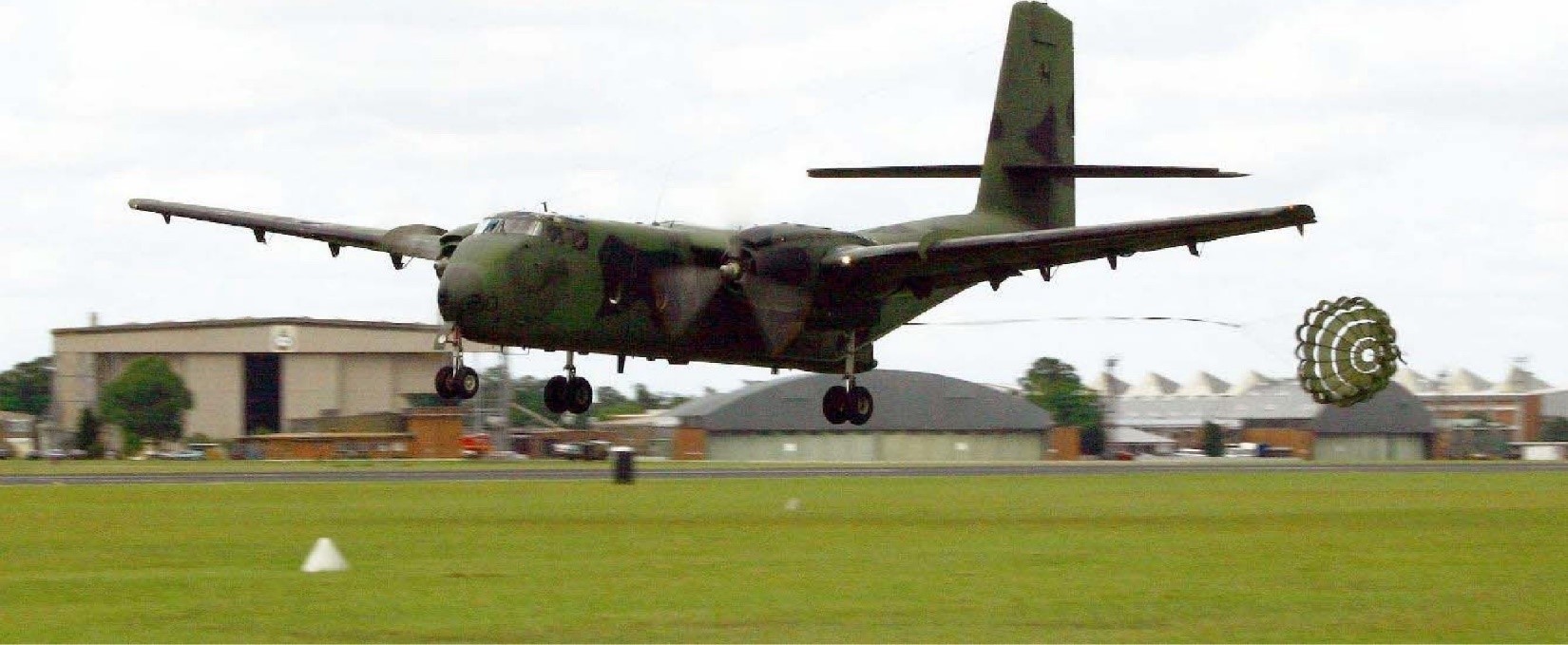
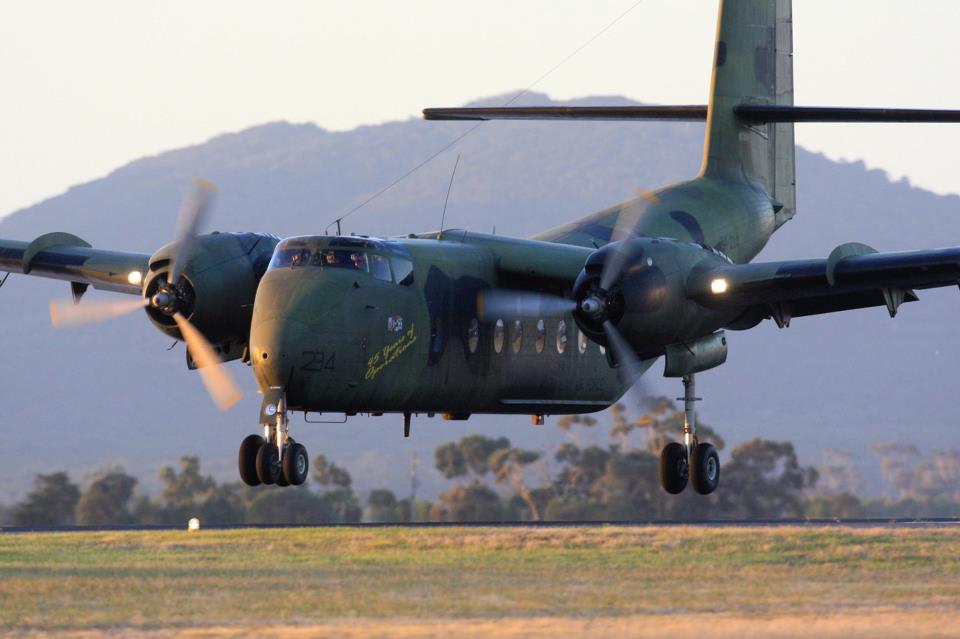
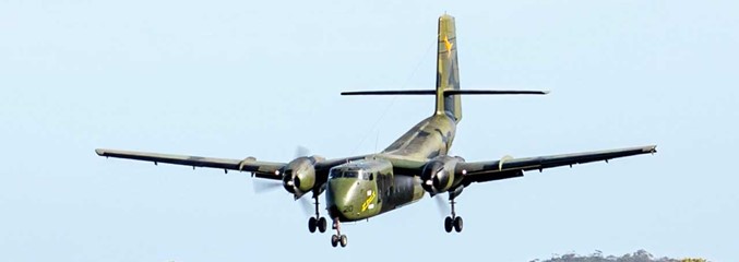
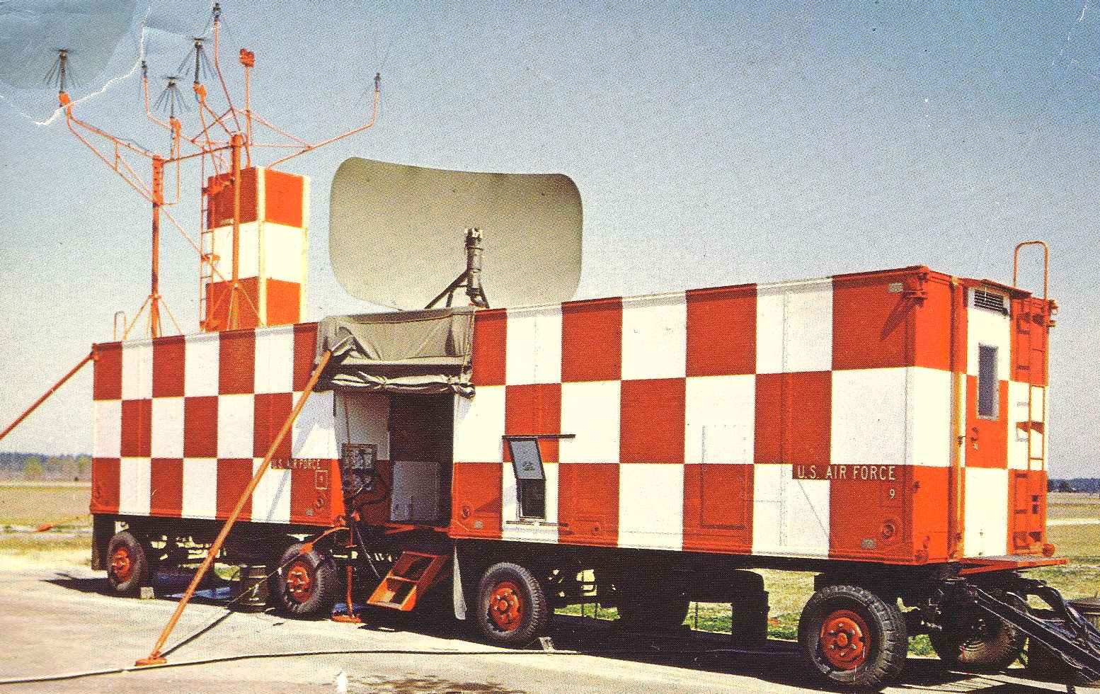
The de Haviland Canada Caribou first flew in 1958. The Royal Australian Air Force (RAAF) received the first three of its Caribous in March 1964 and by the end of 1964, the RAAF had 18 of the 25 it initially ordered, six of which were deployed to Vietnam. Those six brand new Caribous (a seventh was added in 1965) were the first RAAF aircraft into Vietnam. And the last out.
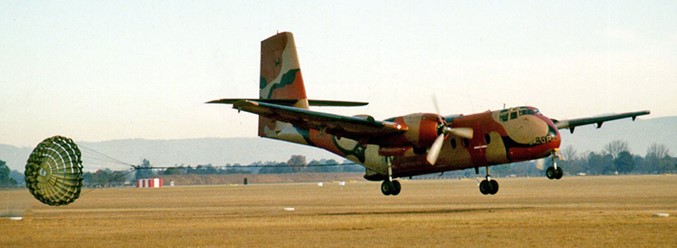
With their rear doors being capable of being opened in flight, the Caribous were able to use a new cargo delivery technique called, Low Altitude Parachute Extraction System (LAPES). The Caribou would fly low over the drop site with its landing gear and flap down and its rear doors open. The cargo pallet to be delivered had a drag chute attached to it and at the Calculated Air Release Point (CARP), the pilot would press a button on his control yoke. That’d release the chute from a small bomb rack located in the rear ceiling of the cargo hold, allowing it to fall out the back of the aircraft. The chute would open then pull the cargo pallet out of the aircraft, so the pallet could plop about one meter onto the ground and skid to a halt.
So why the hell would we do this with 800 litres of fuel, you ask?
Because the troops on the ground needed fuel. That’s why, and if we delivered it with a normal, higher altitude parachute drop, the fuel would be hanging in the sky for a minute or more for the enemy to shoot holes in the drums. And if the enemy had tracer rounds, crikey, it could get lethal for our troops on the ground, real quick.
It usually was fuel in 200 litre drums that we delivered by LAPES. Four of them on their sides, strapped onto a pallet. The drag chute that pulled the pallet out, was about 8 meters across. If the pallet got stuck and hung up on the way out, that 25 foot drag chute, which was now attached to the aircraft, became a serious problem. The Caribou had enough power to keep flying with a hung up load and a drag chute out the back but it was a struggle. If that happened, the chute had to be cut free as soon as possible.
Simple, eh? Well no. It wasn’t. You see that pallet with four, 200 litre fuel drums on it had to be secured before anyone could go behind the drums to cut the chute’s attachment strap, so we had special procedures that’d minimize the risks.
LAPES procedures in a Caribou required a crew of four. Two pilots, one to fly the aircraft, the other to navigate and two crewies in the back to handle the cargo. Two rows of rollers were attached to the floor. When loading the aircraft, the flat pallet of four drums on their side, was put on the rollers and rolled up under the wings to a low barrier that’d stop it going any further forward.
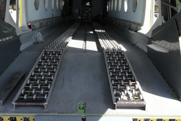
The pallet then had a special, short strap attached from the rear of the pallet, to the floor. That strap would be the final restraint holding the pallet in place during the last few minutes of the drop run. There was a knife blade taped to this strap that would cut the strap when the chute deployed, thereby allowing the chute to drag the pallet out of the aircraft.
With the pallet in place and rigged for the extraction, the load was then further secured with 2,500kg tiedown straps for the take-off and transit flight to the drop zone. When all that was done, another three 2,500kg tiedown straps were secured to floor tiedown points forward of the load, with the three loose end hooks taped together so they could be used quickly as one emergency restraint, should they be needed.
Planning and preparation were the secret to successful LAPES operations. Apart from training and air shows, real life LAPES drops were normally only made in combat zones, so while the crewies prepared the aircraft, the pilots planned the flight, invariably planning to fly as low as possible to minimize exposure to ground fire. These low level flights through hostile territory were hard on the crew, the pilot flying was continually having to make control inputs to avoid the terrain. Flying low, the pilot navigating had fewer references he could use to confirm where they were and the crewies working in the back had to contend with a floor that was at times, pitching and rolling worse than any ship at sea.
Despite that, with everything strapped down and secure, flights into the drop zones were pretty straight forward up until the last five minutes, but with five minute to go, the crewies began removing the safety pins and straps, preparing the aircraft and its load for what was a safe procedure, if nothing went wrong. With one minute to go, both crewies would be in front of the load with their safety harnesses attached to floor tiedown points. The landing gear had been lowered and the rear doors were opened. The second crewie was positioned immediately in front of the load, with the three emergency restraint straps in his hand, ready to snap them onto the big D ring that’d prevent the load leaving should the drop be aborted. The lead crewie was positioned at the manual release handle for the chute, as a back up to the pilot’s electrical release. When all was in place, the lead crewie told the skipper, “The load’s live.”
The skipper would advise the crew when he was ten seconds from releasing and then at the release point, he’d say over the intercom, “Execute!” whilst pressing his red release button. The navigating pilot would turn on the green drop lights in the back as a visual backup to the intercom call and the lead crewie would activate the manual release. The chute would drop out of the bomb rack it’d been in and lob out the back door, dropping down to hit the ground. Contact with the ground at about 150 km/h, would burst the bindings holding the chute’s cover together, while bouncing the unravelling chute back up into the slipstream behind the aircraft’s tail. The opening chute would fully open with a hell of a bang. The attaching strap would snap tight. The knife on the last retaining strap would cut that strap and the full force of the chute would be applied to the load. Those four drums would roar out of the cargo hold at an instantaneous separation speed in the order of 100+ km/h.
If you’ve ever stood with your toes on the edge of a railway platform while a freight train went by at over 100 km/h, you’ll have an understanding of the experience.
When the load had cleared the aircraft, the lead crewie would call over the intercom, “Load’s gone.” The skipper would climb away, raising the gear and flaps as he went. The lead crewie would close the rear doors and both crewies would commence cleaning up the tiedown straps and such while inspecting for any possible damage.
But one day that didn’t happen. On that day the LAPES drops were being organized by the Air Movements Training and Development Unit (AMTDU) at RAAF Richmond, NSW and because the AMTDU Boffins wanted to know exactly what was happening during the execution of LAPES drops, everything being done that day was filmed by cameras both on the ground and in a chase aircraft that was flying loose formation with the drop aircraft. The aircraft was loaded at Richmond, then flown to the Londonderry drop zone, which was a clearing in the scrub a few miles South of Richmond,
Everything went to plan up until the chute hit the ground. The bindings didn’t burst. The chute bounced up into the slipstream wiggling and wobbling about at the end of the attachment strap. But it did not deploy.
The lead crewie called, “The chute hasn’t deployed. We’ve still got the load onboard.”
The skipper called, “Abort the drop. Secure the load.”
The second crewie snapped the three emergency straps onto the D ring.
And BAMMM! The chute opened. The knife cut the final restraint. In the blink of an eye, the load travelled about two feet before the three emergency straps slammed it to a stop and the lead crewie called, “Chutes deployed, but the load’s hung up.”
In a heartbeat, the flight had gone from being a routine procedure, to being bloody dangerous. There were trees in front that the skipper had to clear, he pushed the throttles as far forward as they’d go, and raised the nose. In the back, the crewies knew there were trees, they also knew that the chute was the only thing stopping the load from coming forward so both of them were working frantically to get tiedown straps onto the load. If they hit the trees and the aircraft immediately slow down, if the load wasn’t tied down, the 1,200 kg pallet would come crashing forward to kill all four of the crew.
After what seemed to be an eternity, but was in fact less than a minute or so, the lead crewie called, “The load’s secure, Skipper. You ready for me to go behind it and cut the chute free?” “Not yet, Guys,” the skipper called back. “I’m climbing to 500 feet and turning to go back over the drop site. If we cut it free overhead the site, the Boffins’ll be able to recover it and maybe they’ll be able to work out why it didn’t deploy like it’s supposed to.”
Once over the drop site, the lead crewie went behind the drums and cut the chute free. Released from the horrendous drag of the chute and with the rear doors closed, the crew returned to Richmond.
All further drops for that day, were cancelled while the Boffins rushed the film they had through their dark room. Later that afternoon, everybody who’d been involved in the drop were invited into the viewing room to see what’d happened. It was during this viewing that the crew who’d flown the exercise realized how close they’d come to disaster.
The camera that’d been on the ground at the drop site, showed the caribou struggling to clear the trees. The drag chute clearing the trees by only a few feet. It was obvious on the film, that had the chute caught the trees, the caribou would have been snatched out of the sky, slamming into the ground like a fly swatter.
Which proves once again: It’s better to be lucky than good.
38Sqn, which operated the Caribou at Richmond then at Amberley, has a video showing the Caribou – you can see it below.
A couple of cows were smoking a joint and playing cards. The steaks were pretty high.
What happens when you die?
“Ashes to ashes, dust to dust” fails to capture the reality of our decay. Dust and ashes sound dead, inorganic, dry; the reality is a riot of wet, squishy biology. A dead body is actively consumed by a long line of creatures, from scavengers that peck and tear to wiggling worms and maggots to legions of steadily munching microbes.

Here’s what happens when you die. It’s a play in four acts, which scientists use to reconstruct a rough timeline to estimate the post mortem interval, or time since death.
In the first act, the fresh stage, the body looks pretty much as it did when alive. The action is mostly behind the scenes in the deceased’s tissues. Within a few hours of death, actin and myosin proteins inside muscles become starved of energy and begin to lock together, stiffening the body in rigor mortis. Blood settles by gravity to the lowest points on the body, causing the bruised colours known as lividity and meanwhile, the cadaver is cooling, or warming, to ambient temperature in a process called algor mortis.
During the first act, which typically spans the first two days of decomposition, bacteria launch battles for the corpse’s resources, with groups previously kept in check by the immune system becoming dominant. In healthy living humans, groups known as Firmicutes and Bacteroidetes prevail over the gut, but after death some of these bacteria begin to wane, and others flourish, such as Proteobacteria, group that includes a number of pathogens that the immune system would normally tamp down.
The next act is the early decomposition stage, when the body starts to visibly break down. This is when things start to get really gross. Skin begins sloughing off, and hair falls out. Microbes previously contained by the gut escape and begin consuming other parts of the body. As they deplete the oxygen, bacteria that can survive in low-oxygen conditions start to take over, producing gases that make the body bloat—and smell. Sulfate-reducing Pseudomonas and Bacillus, for example, break down proteins to produce stinky hydrogen sulfide gas, and others break down fatty acids and produce the aptly named cadaverine and putrescine. By the end of the bloat stage, when all the oxygen in the body is gone, a group of strictly anaerobic bacteria called Clostridium (best known because of botulism, caused by Clostridium botulinum, and the potentially deadly Clostridium difficile) takes over the gut, becoming so dominant that some necrobiome scientists call this “the Clostridium effect.”

The smell of decomposition draws more insects, and when the eggs of the first-arriving flies hatch, a clump of maggots may form. Then, as scientists describe it in the book Microbial Forensics, “the maggot mass travels around the body, feeding as it goes and physically tearing at the flesh.”
Peak grossness comes when the abdomen ruptures in what’s called a purge event, dumping fluids out and marking the beginning of the third stage, advanced decay. The skeleton begins to show; the remaining flesh mummifies or forms waxy adipocere. The final stage is skeletonization, when nothing but bones and possibly hair or bits of dry skin remain.
For decades, medical examiners have used this general progression to estimate how long a person has been dead, but all the indicators are far more variable than what a TV show like CSI would have you believe. The chief medical examiner of Wayne County, Michigan in the USA, has performed thousands of autopsies. In at least 10 to 15 percent of them, he says, it was unclear when the person died, a gap in the record that could have significant costs. A broad guesstimate on a death certificate could make a difference in a relevant criminal investigation.
In such uncertain cases, examiners use rigor mortis, lividity, and body temperature to estimate post mortem interval. People are taken aback when they are given a time-of-death window of 12 hours or more for someone who’s been dead longer than a couple of days. If the body is in rigor mortis, depending on its extent, body mass, and the ambient temperature, the person has been dead for 24 hours or less, he says and if lividity is fixed, in other words, “it doesn’t blanch when you push your finger into the body, then you’ve been dead at least 12 hours.”
Body temperature is a useful indicator if the body was kept at a steady moderate temperature since death, but ambient temperatures can change that calculus. “If you come across somebody in subzero temperatures and they’re stiff, well, that’s because they’re frozen and in a hot climate, a body heats instead of cooling, and lividity and rigor speed up”.
It is still a “best-guess” when trying to estimate time of death.
Whoever put the letter “S” in fastfood is a marketing genius.
50th anniversary of RAAF Caribou crash in PNG
A commemorative event was recently held in Papua New Guinea to honour the 25 Papua New Guineans and Australians who lost their lives in a tragic Caribou crash 50 years ago.
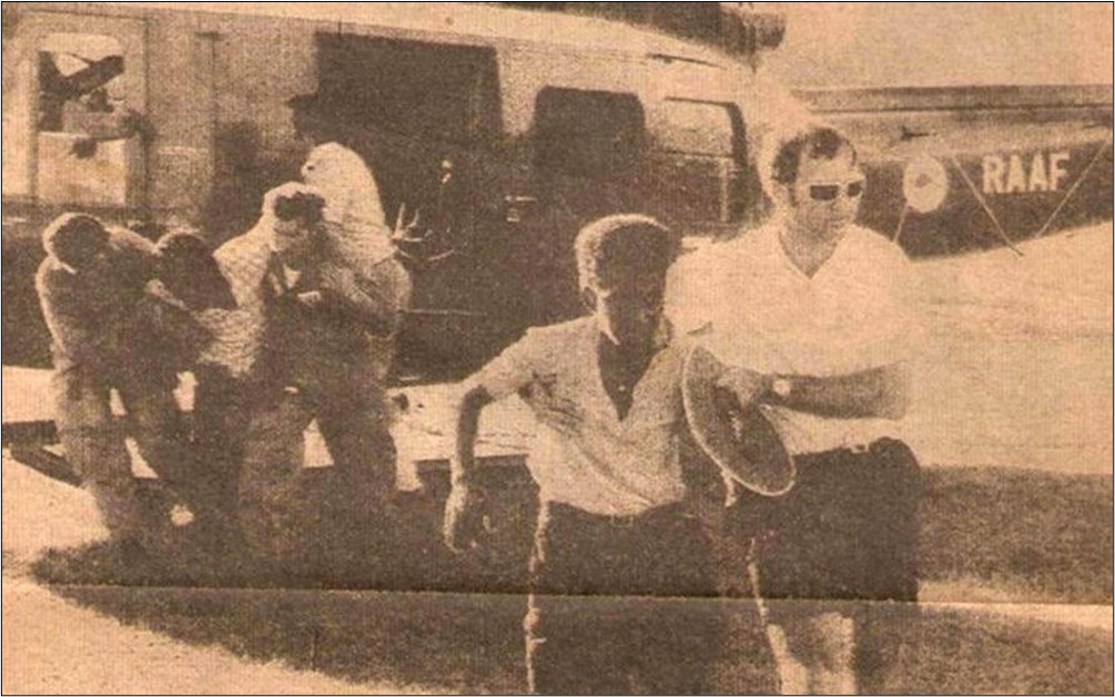
On the 28th August 1972, RAAF Caribou A4-233 took off from Lae heading to Port Moresby. The flight was part of Australia’s partnership with Papua New Guinea and was a way to provide assistance by reuniting young men with their families after the completion of a Papua New Guinean cadet training camp.
The Caribou’s crew included Flight Lieutenant Graham Thomas, Pilot Officer Gregory Ebsary and Corporal Gary Power.
While flying through the Kudjeru Gap, the pilot became concerned that low cloud was going to shroud his vision of the valley ahead and decided to turn around. Unfortunately, he aircraft struck trees and crashed. Most on board died instantly.
Chief of Air Force, Air Marshal Robert Chipman, AM, CSC, was in attendance at the event to pay his respects on behalf of the Australian Defence Force. “Today we commemorate the 50th anniversary of the loss of the RAAF’s Caribou aircraft A4-233,” AIRMSHL Chipman said. “As we remember this tragic event, we reflect on the longstanding bonds between Australia and Papua New Guinea.
“Onboard Caribou A4-233 were 25 Army cadets from De La Salle College and Popondetta High School. Aged between 16 and 18, these fine young men were considering honourable military careers in the service of their nation. Twenty one had bright and promising futures which were tragically cut short by this accident.
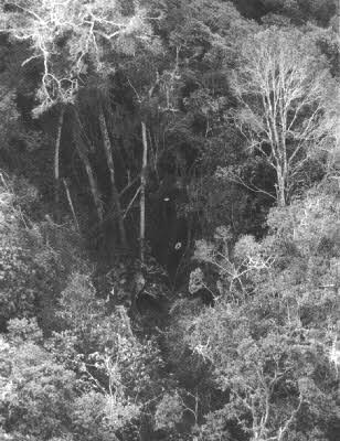
The site of the crash.
“Also on the aircraft were three aviators from the RAAF and a liaison officer from the Australian Army. Like their passengers these young Australians were serving their nation in uniform.”
AM Chipman said that like many who attended the ceremony, he had a personal connection to those lost in the tragic accident.
“My father was also flying Caribous with 35 Sqn in 1972,” AM Chipman said. “We lived in a house in Port Moresby during the months when he flew around the highlands and he was great mates with Graham, the aircraft captain. They joined the RAAF Academy together, learnt to fly Caribous on the same course, and played sport together.
25 PNG cadets were killed in the 1972 crash. “My younger brother is named Antony Graham, in honour of their friendship.
A RAAF C-27J Spartan from 35 Squadron conducted a flypast over the commemorative event, paying their respects to the fallen.
Weather warning!. An auto club warning said anyone travelling in icy conditions should take a shovel, blankets, sleeping bag, extra clothing, including a scarf, hat, gloves, 24 hour supply of food and drink, de-icer, rock salt, torch, tow rope, petrol can, first aid kit and jumper leads. I looked a right idiot on the bus this morning.
Solar Panels explained.

There is a little equation that you should be aware of: P = VI. Power equals voltage by current.
The P equals Power (watts)
The V equals Voltage (volts)
The I equals Current (amps)
A 1,000 watt appliance in your house, running on 240volts will draw about 4.2 amps.
You should also be aware that kW is an abbreviation of kilowatt (1,000 watts) and is a measure of power, whereas kWh represents energy and is a measure of how much power is used or generated in an hour. Theoretically, a 10kWh source should be able to supply 1 kW for 10 hours.
It is estimated that the amount of solar power that hits the ground, at noon, under clear sky at the equator, is 1360 watts per square metre.
That’s the absolute peak theoretical amount of power that exists, not what can be extracted, not what can be converted to electricity. Solar panels are about 15–20% efficient at converting that solar power into electricity, which means they can produce maybe 180–250 watts per square metre at noon, under clear sky at the equator. That means over the course of an 8 hour day, at the equator, under clear sky, you’re generating, at most, 4 kWh of electricity per square metre of panel per day. This could mean it has delivered 0.5kW of power for 8 hours or 1kW for 4 hours – a total of 4kWh. But - as you move north or south of the equator and as clouds reduce the amount of solar power reaching earth, that figure can drop to 1 kWh per square metre per day.
Solar panel systems are rated in kW’s (power output) yet that doesn’t mean a 1kW panel will deliver 1kWh (of energy) to your house, in fact under ideal conditions a 1kW panel could deliver 4kWh to your house per day. You’ll often see solar systems advertised as 6.6kW systems, this means they could deliver up to 26.4kWh to your house in a day – on a good day.
The average house uses about 20kWh per day, if you’re thinking of going solar, a 6.6kW system should do the trick.
Outlook
If you’re like a lot of us and have used Microsoft’s Office for many moons, you’re probably pretty used to and rely on its Outlook module to handle your emails, diary and contacts. Since Office 97, Outlook has had the Navigation Panel, the bit that contains the mail, diary, contact, flagged emails as well as notes, folders and short cuts icons over on the left of your screen and down the bottom.
For some reason, known only to Microsoft, in a recent upgrade, they moved the whole Navigation Panel from down the bottom over to the left side of your screen and at the top. If you’re like us, we would rather they hadn’t because we were used to it where it was. As with a lot of these things, there is a way to move it back to where it “should” be.
Here’s how.
This “Fix” includes altering the Registry and if you’re not au fait with playing with the Registry, it’s probably better you don’t attempt it yourself as you can do a heap of damage very easily, instead get someone who knows their way around the system to do it for you. (The average 14 year old kid would be perfect).
|
Step 1 |
Right click Start > Run then type regedit in the small window, press Enter. |
|
Step 2 |
Navigate to the following registry key HKEY_CURRENT_USER, then click Software > Microsoft > Office > 16.0 > Common > ExperimentEcs > Overrides. |
|
Step 3 |
Locate the ‘Microsoft.Office.Outlook.Hub.HubBar’ string value and set it to ‘false’. Then click OK and restart Outlook to check if it works. |
|
Step 4 |
If the string “Microsoft.Office.Outlook.Hub.HubBar” doesn’t exist, create it by right-clicking on Overrides in the left pane and selecting New > String Value then Paste “Microsoft.Office.Outlook.Hub.HubBar” in the new entry that appears in the right pane. |
|
Step 5 |
Double-click the new name. |
| Step 6 | Enter “False” in the Value data field and Click OK. |
|
Step 7 |
Close and restart Outlook. |
This method will get the navigation toolbar back to the bottom of the screen just as you prefer. If you want to have a go at it yourself, there's a video below on how to go about it.
I realised I had to go to the toilet. I got up, walked across the house to the pantry, when I got there, I couldn’t understand what I was doing in the pantry, but I remembered I had to go to the toilet. I left the pantry and walked to the toilet, sitting on the throne I remembered why I went to the pantry – toilet paper.
![]()
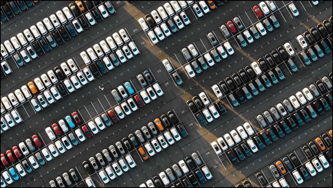
How to find your parked car with an iPhone or Apple Watch.
Forgetting where you’re parked is no fun, especially in crowded parking lots that seem to go on forever, but, if you have an iPhone and your car has CarPlay or Bluetooth connectivity, you can easily find your vehicle. Here’s how!
How your iPhone knows where you park.
Your iPhone can recognize when you’ve parked, provided it’s paired with your car in some capacity. This works by detecting when you switch the ignition off or when you disconnect your device from your car, severing the connection between the two.
For this to work, you’ll need a car with CarPlay or Bluetooth audio. CarPlay is Apple’s in-car standard for interacting with iPhone apps while driving, available in both wired and wireless forms.
Bluetooth audio includes anything from manufacturer-provided head units to third-party car stereos that have been custom-installed. While most should work, compatibility with parked car location marking may vary. Ultimately, it depends on whether your iPhone recognizes the Bluetooth system as car audio.
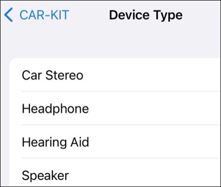
If you’re having trouble getting parked car location marking to work after syncing your iPhone with your car’s Bluetooth system, try labelling your vehicle as “Car Stereo” to see if that helps. Head to Settings > Bluetooth and tap on the “i” button next to your car’s stereo. In the menu that opens, tap on “Device Type” and choose “Car Stereo” from the list.
|
You’ll also need to have the following services enabled on your iPhone:
Location Services: Go to Settings > Privacy & Security > Location Services and toggle Location Services on. Significant Locations: Go to Settings > Privacy & Security > Location Services > System Services > Significant Locations and toggle Significant Locations on. Show Parked Location: Go to Settings > Maps and toggle Show Parked Location on.
If all of the above is enabled, your iPhone should be able to mark where you’ve parked. There’s no need to do anything else. |
|
|
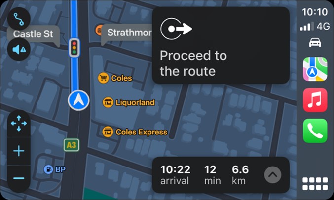
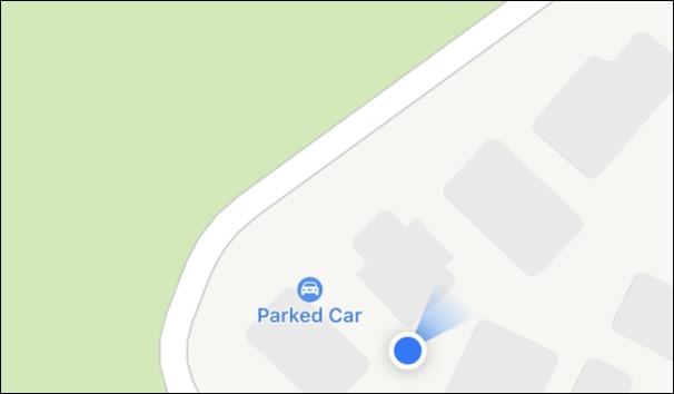
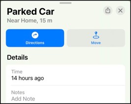
Find Your Car on Maps
This feature uses the Maps application that comes with your iPhone. You can find your car by launching Maps and then typing “Parked Car” into the search box.
You can also find your car by panning around the map. You may need to zoom in for it to become visible, especially if you’re nearby. Your iPhone’s blue location marker may obscure it.
Apple says that your parked car’s location won’t be shown in a location where you “frequently park, like at home or work,” but we’ve noticed it works a bit differently in practice.
|
|
|
|
|
|
In a location that Apple has labelled as “Home,” we’ve seen the Parked Car label appear regularly.
You can see how long ago your car was parked in the listed location by tapping on the marker in the Maps app. You can also add notes and a photo to your Parked Car in this field or manually move the marker using the “Move” button.
|
|
|
|
|
|
How to remove your car’s marker.
If you want to manually remove your car’s location from the Maps app, you can do so. First, tap on the marker, scroll to the bottom of the “Parked Car” overlay that appears, and then tap on the “Remove Car” button.
You can disable the feature under Settings > Maps by toggling “Show Parked Location” off. |
|

Find your car with your Apple Watch.
Assuming the feature works on your iPhone, you can also use your Apple Watch to find your car. The easiest way of doing this is with the redesigned Compass app in watchOS 9. For this to work, you’ll need an Apple Watch Series 5 or later (including both models of SE and the Ultra) with a Compass. Launch the Compass app, then look for a blue waypoint on your compass dial. You can turn the Digital Crown to adjust the dial to get a better idea of how far away your car is. Tap on a waypoint to get more information about it, then tap “Select” to see a pointer that will guide you to your waypoint.
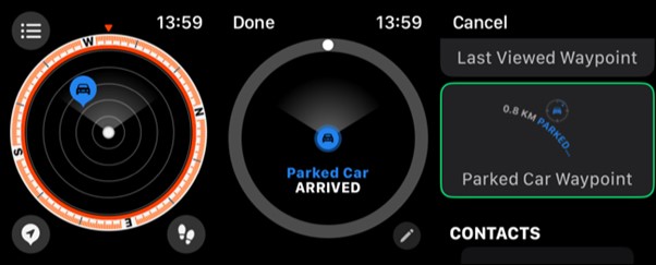
You can even add a Complication to your Watch face that points to your parked car. Tap and hold your Watch face to customize it, tap “Edit” on the face you want to edit, then scroll left to the “Complications” display.
Tap on a Complication slot to customize it, then scroll with the Digital Crown until you find the “Parked Car Waypoint” under the “Compass Waypoints” section. This complication will always point toward your parked car, with a display that shows the distance.
|
Consider marking your car with an AirTag
Your parked car’s location is static, this means that once it’s recorded, it won’t be updated until your iPhone reconnects with it again. If someone moves your car while you’re out of range, you won’t be able to find it using the location marked in Maps.
An AirTag may be able to help. When an AirTag comes within range of another iPhone, its location is recorded and sent to Apple. This makes it effective at tracking objects like a car, providing additional security against theft. Once activated and labelled, an AirTag will appear in the Find My app on the “Items” tab. You can use devices like an iPhone or Apple Watch to find AirTags, put items into “Lost Mode,” and play a sound to locate lost items. |
|

I’m dreaming of a white Christmas. If that fails, I’ll drink red!
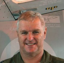
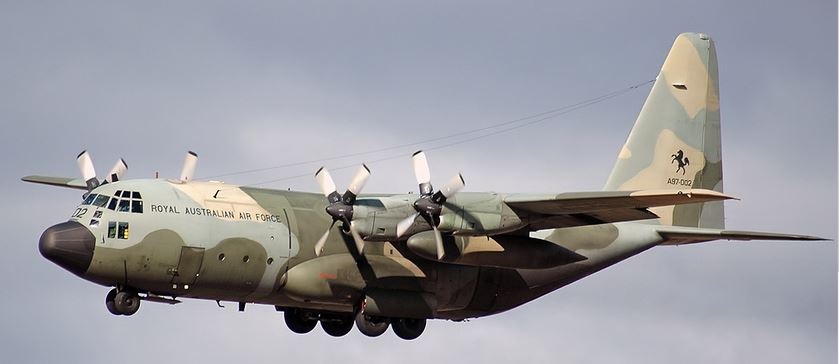
A close call in a Hercules.
Phil Frawley
After about two years flying as a co-pilot on the venerable C-130 Hercules, I was being groomed for captaincy and as such I was doing a lot of flying with the squadron executives to ensure that I was capable of being a captain. On this particular mission I was programmed to fly with the CO of the squadron. This CO was a particularly hard man who was obsessed with being ahead of schedule at every opportunity and drove his crews harshly to achieve his aims.
The mission itself was a comparatively easy one, known as an East Coast Courier. The task was simply to fly from Richmond to Amberley and then onto Townsville and return the same way. At each stopover we would pick up general cargo and passengers as required by the RAAF Air Movements organisation, who determined what cargo and passengers needed to be transported to the various bases.
On taxiing into Amberley, the flight engineer asked me for the required fuel load to continue on to Townsville and as I gave him the necessary upload, I was countermanded by the CO who would not let me take on any fuel. The CO was trying, as usual, to get well ahead of schedule and I perceived that he was testing my ability to fly the aircraft to its maximum economical fuel burn. The problem was that the weather in Townsville was not very good
At this time different weather forecasts for airfields were issued for military and civilian aircraft. Additionally military aircraft had access to a better landing approach guidance capability than was available to civilian airlines. This was called a Ground Controlled Approach or GCA. The GCA used specially trained Air Traffic Controllers using a very accurate radar system that could inform you of your exact tracking and glidepath down to 200 feet above the runway. To that end, the military forecast on this day for Townsville did not require military aircraft to carry any holding fuel for the bad weather affecting Townsville, but the civilian forecast did. Holding fuel requirements are detailed in airfield forecasts and may require either 30 or 60 minutes holding fuel to allow for possible weather breaks which would ensure a successful approach and landing.
At Amberley we arrived with enough fuel to continue to Townsville on a fine weather day but not enough for any bad weather eventuality. I was concerned about the civilian forecast and told the CO that we would be wise to take on more fuel but he refused to allow it. It is worthwhile explaining that the squadron had just recently transitioned to a newer model Hercules (H) which was more powerful and as such consumed more fuel and so the corporate knowledge of its performance was not fully understood by the older aircrew in the squadron who had operated the previous model (A) for many years. Most of the younger aircrew, including myself, were very aware of the implications of how the new aircraft performed due to the extensive training that we had been given.
So it was that we pressed on to Townsville. As we entered the cruise, the navigator received weather updates for Townsville that indicated deteriorating conditions requiring at least 60 minutes holding, but these were the civilian forecasts. I again expressed my deep concerns to the CO who quizzed me about my options and I said that the flight leg was not long enough to conserve enough fuel to satisfy the Townsville forecast and that we should divert to Rockhampton to take on more fuel. Again, he refused. It then came to light that because we were a military aircraft and the GCA was available to us we didn’t need to have the extra holding fuel and we were perfectly legal.
I explained that even though that was technically correct, the conditions at Townsville were worsening by the minute and we might be caught out with nowhere to go.
Now let me explain the GCA at Townsville. Normally a GCA would pick you up from approach radar directly to around 10 miles but at Townsville the leg to come to this point is about 30 miles extra and a missed approach and follow on approach could be a distance of around 60 miles; a long way. This is due to the terrain in and around Townsville.
At the descent point for approach to Townsville, about 80 miles out, Air Traffic Control declared that, due to heavy rain and very low cloud, Townsville airfield was closed to all operations. We had enough fuel for a visual approach and no more. I don’t know if the sudden gravity of the situation hit the CO, but he didn’t show it. I flew the GCA and I admit I didn’t do a very good job because I was so scared. When we got to the absolute minimum descent altitude for the approach we could not see a thing. At this point the CO took control of the aircraft and descended to approximately 100 feet above the ground. I looked out of the chin window and I could see the houses below us that were very close and I thought that we were actually going to crash. A moment or two later the flight engineer yelled that he could see the runway off to our right and he guided the CO to the spot.
The first 1000 feet of the runway was visible and we landed into a wall of water just beyond. We found it difficult to taxi off the runway with the poor visibility and as we made it onto the taxiway the outboard engine fuel tank empty lights illuminated. On board the aircraft was some dangerous cargo that had to be offloaded in a special area, so we taxied to that area where the inboard engine tank empty lights illuminated just prior to shut down. Following the offload of the dangerous cargo, the CO elected to start the aircraft and taxi it to the Air Movements ramp to prepare for the return leg. The flight engineer attempted to start the auxiliary power unit but there wasn’t enough fuel to even start this unit and the aircraft had to be refuelled before it could be moved. The CO did not acknowledge the danger that he had placed his crew and his passengers in, and never spoke of it at any time.
I spoke to the crew, away from the CO, and they realised the danger and expressed their concern at what had happened. They also agreed with my assessment of the situation as it unfolded way back at Amberley, although they admitted that, at the time, they believed the CO knew more about the information than any of us. I went on to gain my captaincy in what was then record time for the squadron, not because of my ability but because many pilots were leaving the RAAF for the airlines. I really enjoyed my time flying the Hercules and I look back on it with a lot of pride.
Will electric vehicles fix Global Warming? Click the pic below.

I don't think we get smarter as we get older.
We just run out of stupid things to do.

Velly Intelesting - but stoopid!!
Back Go to page: 1 2 3 4 5 6 7 8 9 10 11 12 13 14 15 16 17 18 19 20 Forward